Civil Site Design v17.014 will be released very soon. This version contains a number of fixes and some new functionality. Also, this version will be available for BricsCAD v17 users.
New functionality added includes:
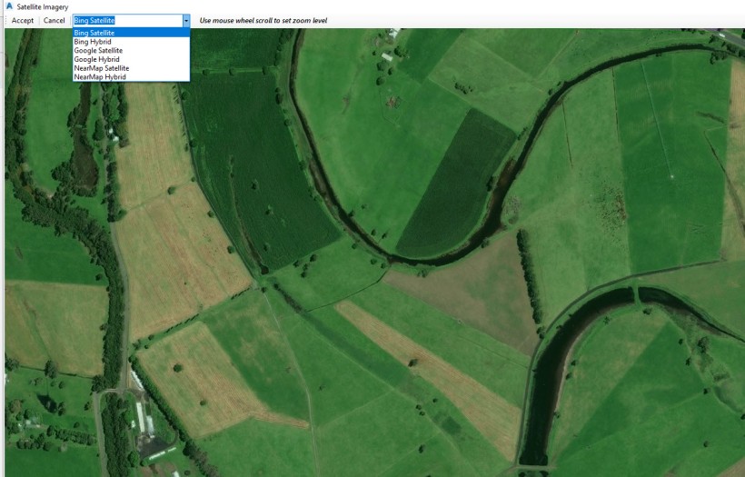
Improvements to Image From Satellite command.
We now allow users to select from a number of different map providers. Users can select from the following providers:
- Bing Satellite
- Bing Hybrid (includes road names)
- Google Satellite
- Google Hybrid (includes road names)
- NearMap Satellite
- NearMap Hybrid
To use some of these map providers, users might be required to enter further login details in the Model Viewer ‘Viewer Settings’.
Fast Refresh option added to Model Viewer
Trimming boundaries to the base surface is the slowest part of refreshing Model Viewer. Users who are working on large design projects who want a faster refresh can now benefit from the ‘Fast Refresh’ option.
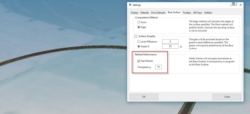
When ‘Fast Refresh’ is turned on (via the Viewer Settings), the base surface will not be trimmed and a transparency is added to the base surface, so that design data can still be seen.
